


Voting District 0108, Tom Green County, Texas
About
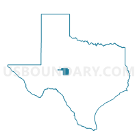
Outline

Summary
| Unique Area Identifier | 677582 |
| Name | Voting District 0108 |
| County | Tom Green County |
| State | Texas |
| Area (square miles) | 67.26 |
| Land Area (square miles) | 67.24 |
| Water Area (square miles) | 0.03 |
| % of Land Area | 99.96 |
| % of Water Area | 0.04 |
| Latitude of the Internal Point | 31.54210700 |
| Longtitude of the Internal Point | -100.26356120 |
Maps


Graphs
Select a template below for downloading or customizing gragh for Voting District 0108, Tom Green County, Texas


Neighbors
Neighoring Voting District (by Name) Neighboring Voting District on the Map
- Voting District 0009, Runnels County, TX
- Voting District 0110, Tom Green County, TX
- Voting District 0112, Tom Green County, TX
- Voting District 0131, Tom Green County, TX
- Voting District 0145, Tom Green County, TX
- Voting District 0155, Tom Green County, TX
- Voting District 0203, Concho County, TX
- Voting District 0254, Tom Green County, TX
- Voting District 0306, Tom Green County, TX
- Voting District 0348, Tom Green County, TX
Top 10 Neighboring County Subdivision (by Population) Neighboring County Subdivision on the Map
- San Angelo CCD, Tom Green County, TX (80,050)
- East Tom Green CCD, Tom Green County, TX (4,769)
- Miles CCD, Runnels County, TX (1,220)
- Eola-Paint Rock CCD, Concho County, TX (777)
Top 10 Neighboring Place (by Population) Neighboring Place on the Map
Top 10 Neighboring Unified School District (by Population) Neighboring Unified School District on the Map
- San Angelo Independent School District, TX (94,460)
- Grape Creek Independent School District, TX (5,842)
- Wall Independent School District, TX (4,157)
- Miles Independent School District, TX (1,724)
- Veribest Independent School District, TX (1,150)
- Paint Rock Independent School District, TX (672)
Top 10 Neighboring State Legislative District Lower Chamber (by Population) Neighboring State Legislative District Lower Chamber on the Map
Top 10 Neighboring State Legislative District Upper Chamber (by Population) Neighboring State Legislative District Upper Chamber on the Map
Top 10 Neighboring 111th Congressional District (by Population) Neighboring 111th Congressional District on the Map
Top 10 Neighboring Census Tract (by Population) Neighboring Census Tract on the Map
- Census Tract 3, Tom Green County, TX (5,309)
- Census Tract 16, Tom Green County, TX (4,769)
- Census Tract 8.02, Tom Green County, TX (4,250)
- Census Tract 7, Tom Green County, TX (4,228)
- Census Tract 9503, Concho County, TX (4,087)
- Census Tract 9505, Runnels County, TX (1,974)